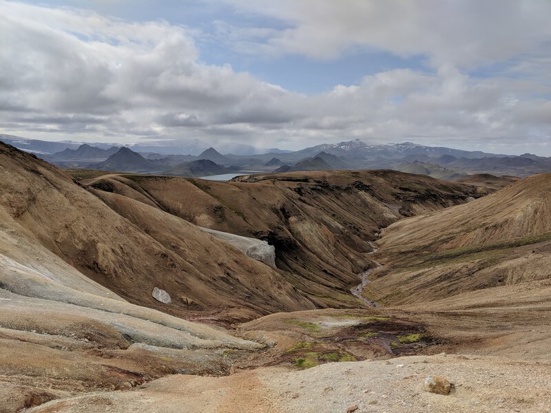
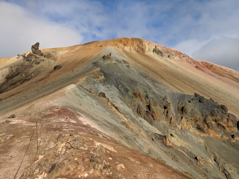
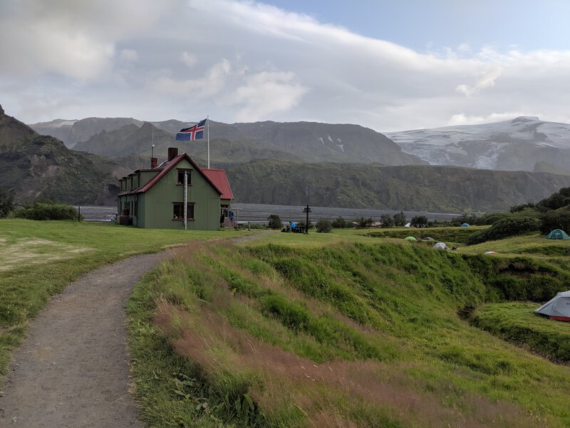
Earlier this week, I hiked the Laugavegur trail through Iceland's southern highlands. The Laugavegur trail is a 55km multi-day hike, considered to be one of the most beautiful trails in the world.

There is useful information about the trail on Iceland Touring Association (Ferðafélag Íslands, FI) website.
The hike consists of 4 legs:
The FI operates huts and campsites at the endpoints of each leg. The huts can be booked in advance for sleeping. However, I opted to camp instead because I didn't want to sleep in a shared space. Camping is also more flexible because you don't have to book in advance. The disadvantage of camping is that you have to carry a tent and mat (+5 kg) and it takes time and energy to setup and take down the tent each night. It could also be miserable in bad weather - luckily this wasn't an issue for my trip. The privacy of a tent is good but you're still near to the other campers, many of whom are travelling in groups, and tents are not soundproof.
I rented my camping equipment in Reykjavík from Iceland Camping Equipment (tent, mat, sleeping bag, gas stove, cooking utensils, rain-proof jacket and trousers). Like everything in Iceland, the prices are expensive, but it's cheaper than buying new equipment and more convenient than transporting it on the aeroplane. The equipment all worked fine and the pick up and drop off was quick.
Many of the hiking guides on the web stress the need for fancy hiking shoes and socks. I just used my Nike running shoes and standard socks, and it was fine.
I also didn't bother bringing hiking poles. For the most part, this was a good move. However, there were a couple of difficult and slightly scary slopes where I end up sliding and scrambling with my hands. Hiking poles would have been useful there but still probably not worthwhile overall.
There are several rivers that you have to cross. For a couple of them, I just walked straight through with my shoes on to save time. However, this was a bad move. Some of the rivers contained sand which got inside the shoes and socks and mashed my toes in the walk afterwards. For other crossings, I just walked barefoot through the river and this was fine. I don't think bringing separate river crossing shoes are necessary.
The recommendation from FI is to do one leg per day, meaning 4 days in total. I initially planned to follow this but changed for a couple of reasons.
Firstly, it turns out that camping in Hrafntinnusker is not recommended because, being at the top of a mountain, it can get very windy and cold, and would be extra miserable if it rains. Good weather on the lower parts of the trail means ~10 degrees Celsius during the day with light rain and wind speed of 2 m/s, so even good weather at the top is probably not going to be pleasant.
So I decided to skip camping in Hrafntinnusker and do the first two legs in one day. This worked out fine - it took me about 3 hours to finish the first leg and 4 hours for the second.
Similarly, I decided to combine legs 3 and 4, stopping in Emstrur for lunch only.

This is a popular hiking trail. There were perhaps 30-50 people in the huts and tents. I started early in the morning to try to avoid most of them. Luckily the trail has many hills so people ahead of you are often hidden and you can enjoy the landscape.
All the huts provide water and toilets. (There are also a few rivers with drinkable water along the trail, especially on legs 3 and 4.)
The campsites charge a camping fee and some of them sell some basic supplies (e.g. soft drinks). They all accepted cards.
Hrafntinnusker and Emstrur are the most remote huts, with no road access and the most basic facilities. I didn't get phone reception at either of these (but did at the other huts).
Landmannalaugar and Þórsmörk are the most well equipped and the are only ones with bus access.
There are no charging facilities or electricity so it’s best to bring a powerbank or spare batteries for your gadgets.

The first two legs had the most interesting and varied scenery - smoking geysers, lava sand and rocks, snow, rivers. The final two legs were more monotonous - vast lava fields. All beautiful and worth seeing though. Þórsmörk is also a beautiful area - I'd consider going there for day hikes in the future.

There are sign-post markers every 100m or so along the trail and the pathway is quite clear. The risk of getting lost is quite low unless there’s very bad visibility. I didn’t get the sense of any human danger along the route - it’s quite remote so any criminals would have to be quite determined to come there. There are many cliffs and steep hills which could be dangerous if you slip. A couple of people have died along the route in the past (e.g. in a blizzard near Hrafntinnusker in June 2004) and you see some memorials for them on the way.
Reykjavik Excursions and Trex provide bus services to Landmannalaugar and Þórsmörk a couple of times per day.
By the end of the hike, I was pretty tired. It was the first time I'd been hiking with a heavy backpack, which took some time to adjust to.
One mistake I made was skipping lunch on the first day (due to rain starting in Hrafntinnusker) - I ended up being exhausted by the end of the day. The second day, I took 45 minutes to have a proper lunch and it felt much better.
I don't regret combining the legs into two days - camping in these places isn't comfortable and I'd have had to spend extra hours in a cramped tent. It would be a different situation if hiking in a group.
As mentioned above, walking through rivers with shoes on was a bad move.
I was originally planning to bring a DSLR, wide angle lens and tripod to take some landscape photos. However, I ended up not being able to fit all the equipment into my rucksack, and even if I had, the extra weight would have been significant. I don't regret this too much - the photo quality from my Google Pixel 2 is quite decent. If I were to go back again specifically for photography purposes, I'll plan the hike differently e.g. not necessarily walk the entire trail, just day hike from Landmannalaugar or Þórsmörk, go early in the morning before other hikers are awake, and plan for specific shots. It could have been worth taking a gimbal for better phone videos.
I do regret not continuing on from Þórsmörk to do the Fimmvörðuháls trail. I didn't plan to do it due to time constraints and I was too tired anyway to face another 1000m of elevation. Since it starts from Þórsmörk, it's something I'd consider doing in the future.
I really enjoyed the hike overall - the scenery is beautiful. Multi-day hiking and camping was an interesting new experience too, though camping itself wasn’t particularly fun.